
News | Events
We are out there !
Read the Copernicus article for e-shape pilot 4.1 [showcase: ecosystem]
Hits: 1830
Did you know that Earth observation data from the Copernicus Sentinel satellites are fed into the Copernicus Services? First launched in 2012 with the Land Monitoring and Emergency Management services, these services provide free and open support, in six different thematic areas.
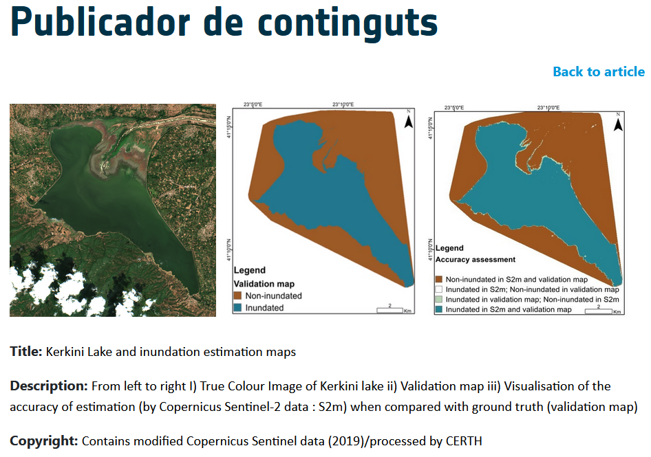
Earth Observation data offer a powerful approach for accurate and cost-effective monitoring of hydrological regimes and seasonal inundated transition zones. Leveraging the capacity provided by the Copernicus Sentinel-1 and Sentinel-2 missions, the Centre for Research and Technology Hellas (CERTH) has developed automatic services for the creation of inundation maps.
Lake Kerkini is an artificial reservoir located in Northern Greece, constituting an area of abundant biodiversity as well as a prominent nesting site for migratory birds. With a spatial coverage of 70-76 km2 and a basin extending over 11,600 km2, Kerkini is a Natura 2000 protected site and a RAMSAR wetland of international importance.
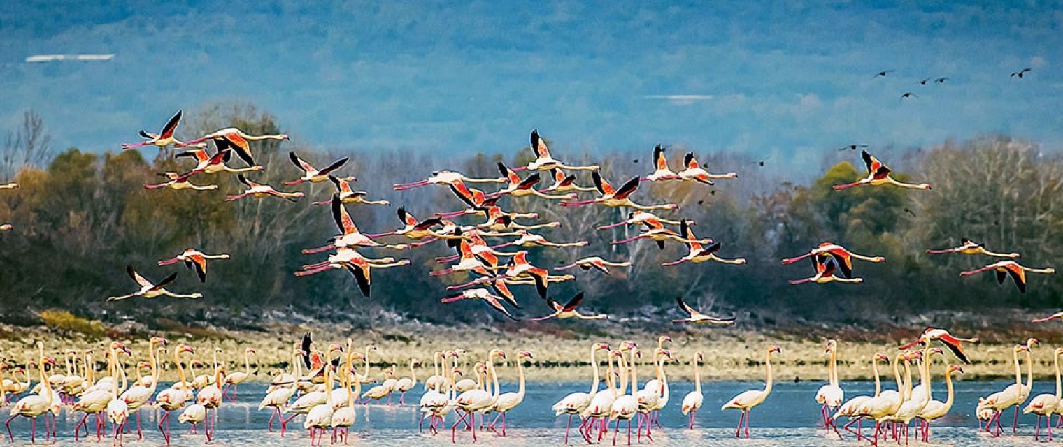
An ecosystem of notable diversity has developed here, hosting over 300 species of birds, 1300 plant species and the largest water buffalo population on a national level. However, Kerkini’s ecosystem has been impacted from the intense use of its resources throughout the years and changes to water extent due to human-induced pressures, along with uncontrolled, frequent, and extreme flooding events.
Ioannis Manakos, Principal Researcher at the Centre for Research and Technology Hellas (CERTH), comments, “The new generation of satellites, with the improved spatial and temporal coverage provided by the Copernicus Programme, offer incredible capacity for the monitoring of seasonal inundation regimes".
“The freely available Copernicus Sentinel data and their potential for integration into complete online automatic services will allow all interested parties, even non remote sensing professionals, to greatly benefit from the abundance of Sentinel spaceborne data— indispensable tools of modern era in Earth observation” concluded Dr Manakos.
Find the full article here


Acknowledgment
The e-shape project has received funding from the European Union’s Horizon 2020 research and innovation programme under grant agreement 820852